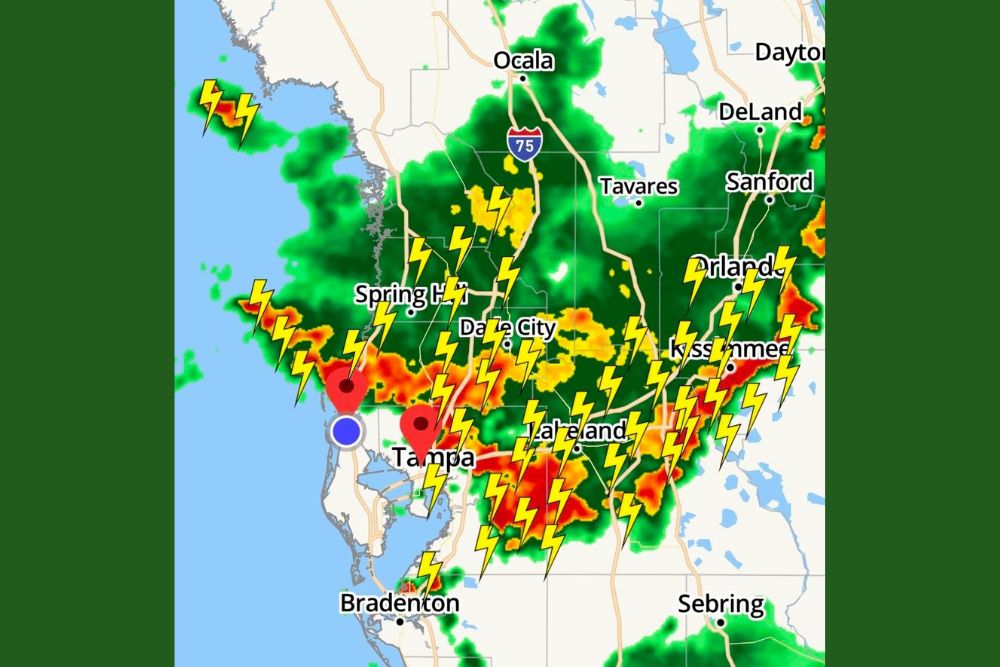
TAMPA BAY, FLORIDA — Heavy rain continues to move south across west-central Florida, tracking through Spring Hill, Dade City, Tampa, and Lakeland with widespread cloud-to-ground lightning accompanying the activity. As of the latest radar, nothing has reached Pinellas County yet, though forecasters indicate that will change shortly as the storm complex continues its southward push through the region.
Widespread Storms Track From Spring Hill Through Lakeland
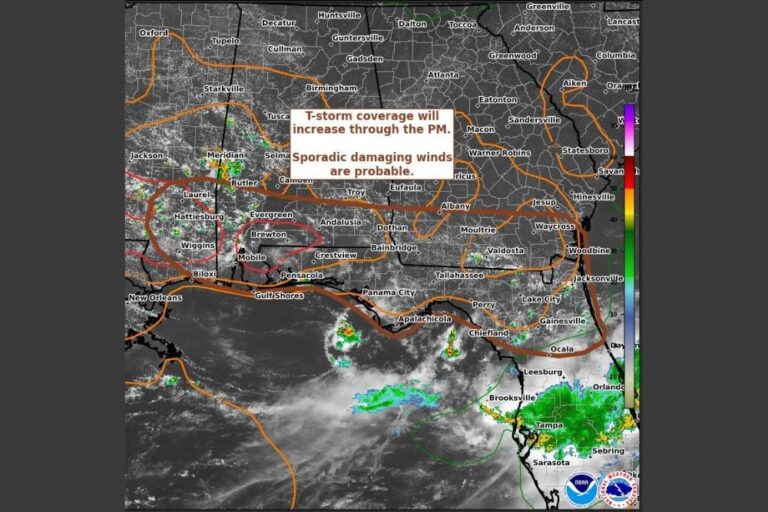
Radar shows an extensive line of storms producing heavy rainfall and frequent lightning stretching from Spring Hill and Dade City through Tampa and continuing east toward Lakeland and Kissimmee.
This broad coverage reflects a significant, active weather event affecting a wide stretch of west-central Florida, with red and orange radar returns indicating some of the heaviest rainfall rates within the overall complex.
Pinellas County Has Yet to See Impacts
As of the latest update, nothing has reached Pinellas County, positioning it just west of the current heaviest activity tracking through Tampa and the surrounding Hillsborough County area.
Forecasters indicate this will change shortly, suggesting Pinellas County residents should prepare for the arrival of heavy rain and lightning as the broader complex continues its southward and westward progression.
Orlando and Kissimmee See Significant Storm Activity
The eastern portion of the radar image shows substantial storm coverage extending through Orlando and Kissimmee, with numerous lightning strikes indicated across this stretch of central Florida.
This activity suggests the heavy rain and thunderstorm event spans a wide east-west corridor, affecting communities from the Gulf Coast near Tampa Bay all the way to the Orlando metro area simultaneously.
Bradenton and Sebring Also Within the Storm’s Reach
Farther south, Bradenton and Sebring are also showing storm activity on radar, indicating the complex extends beyond just the immediate Tampa Bay and Orlando corridors into the broader central Florida region.
This wide geographic spread means residents across a large portion of west-central and central Florida should be prepared for heavy rain and frequent lightning as the overall system continues developing.
Residents Urged to Monitor Radar as Storms Continue South
Given the active and expanding nature of this storm complex, residents throughout the Tampa Bay region, including those in Pinellas County who have not yet seen impacts, are encouraged to monitor radar closely.
Frequent lightning accompanying this system poses a hazard for anyone outdoors, making it important for residents across the affected region to move indoors as the storms continue their track southward and westward.